
Traveler Buddy
$ $
Handpicked collection of the most popular and highly-rated Travel & Location applications


Wanderant helps you research and organize trips.

BlaBlaCar is an online marketplace for carpools.

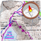
ArcGIS is a geographic information system (GIS) for working with maps and geographic information.

Flavorit is a restaurant discovery platform.

Find My Friends is an application and service to find current locations of friends.

NAVIGON is a GPS navigation software.

CasperJS provides scripting & testing for PhantomJS and SlimerJS.

Turtle Sport is a free software to communicate with GPS for Sports and Fitness.

GeoCha is a local information discovery platform.

Apple Maps is a web mapping service.

Dasher Messenger provids a way to message friends.

MIDAS is a web based room scheduling software.

Google Trips makes exploring the world easier by organizing your essential info in one place and making it available even offline.

Quick Settings is an android app to toggle control panel.

ScheduleOnce is a platform to schedule customer appointments, group meetings and one on one meetings.

Hound gives you fast and deep results to what you ask for, such as looking up the weather, placing a phone call, sending a text message, finding a hotel that matches your detailed criteria, navigating to an address, checking the stock market, searching and playing music, and even playing interactive games.

Mapbox is a provider of custom online maps.

Bikemap is a bike route collection.

Star Chart is an astronomy and star gazing app.

Google Places is a local places listing portal.

Citymapper is a journey planning service and mobile app which covers specific large cities in Europe, North America and other countries.

MapQuest is a GPS and Navigation app.
Latest additions to our Travel & Location software collection